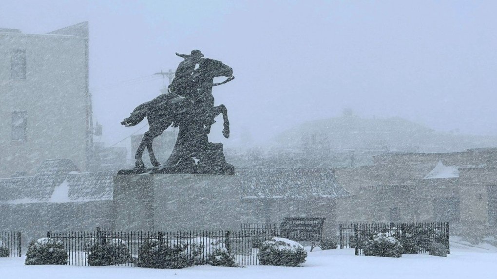
A flurry of snow, ice, wind and falling temperatures caused dangerous travel conditions in parts of the central United States on Sunday, while a disruptive winter storm brought the possibility of the “heaviest snowfall in a decade” in some areas.
Snowfall and ice covered major highways in parts of Kansas and Indiana, where the state’s U.S. National Guard was activated to help stranded motorists. At least 8 inches of snow was expected, particularly north of Interstate 70, as the U.S. National Weather Service issued winter storm warnings from Kansas and Missouri, where blizzard conditions were reported, to New Jersey through the Monday.
“For places in this region that receive the greatest amounts of snow, it may be the heaviest snowfall in at least a decade,” the weather service said early Sunday.
About 63 million people in the U.S. were under some type of winter weather watch, watch or warning on Sunday, according to Bob Oravec of the National Weather Service.
The polar vortex of ultracold air usually remains locked around the North Pole, spinning like a top. But sometimes it escapes or spreads to the United States, Europe or Asia, and that is when a large number of people experience intense doses of cold.
Studies show that a rapidly warming Arctic is partly to blame for the increase in stretching, or drifting, of the polar vortex.
Snow and ice forecast
In Indiana, snow completely covered portions of Interstate 64, Interstate 69 and U.S. Route 41 and Indiana State Police pleaded with motorists to stay off the roads as snowplows worked to keep the rate of precipitation.
“It’s snowing so hard that the snow plows go through and then within half an hour the roads are completely covered again,” said Sgt. Todd Ringle said.
Part of I-70 was closed in central Kansas Saturday afternoon. About 10 inches of snow had fallen in parts of Kansas and snow and snow totals for parts of Kansas and northern Missouri were forecast to reach 14 inches (35.6 centimeters).
The storm was forecast to then move into the Ohio Valley, and severe travel disruptions were expected. It will reach the Mid-Atlantic states Sunday through Monday, with a hard freeze expected as far south as Florida.
Severe thunderstorms, with the possibility of tornadoes and hail, were also possible ahead of the storm system’s cold front as it crosses the Lower Mississippi Valley, the National Weather Service warned.
Parts of upstate New York saw three feet (0.9 meters) or more of snow due to a lake effect event that is expected to last through Sunday afternoon.
Car accidents begin with the arrival of the storm
A fire truck, several tractor-trailers and passenger vehicles overturned west of Salina, Kansas. The platforms also buckled and fell into the ditches, state Highway Patrol Trooper Ben Gardner said.
He posted a video showing his boots sliding across the asphalt of the road like an ice skating rink.
“We’re in it now,” Gardner said as he drove to the crash scene. Online, he asked for prayers and warned that some roads were almost impassable.
The governors of neighboring Missouri and nearby Arkansas declared a state of emergency. Blackout conditions threatened to make driving dangerous or impossible, forecasters warned, and increased the risk of becoming stranded.
Air and rail travel was also affected
Nearly 200 flights in and out of St. Louis Lambert International Airport were canceled Sunday, according to tracking platform FlightAware.
Kansas City International Airport temporarily halted flight operations Saturday afternoon due to ice. Dozens of flights were delayed, including a charter plane carrying the Kansas City Chiefs, before the runways reopened.
“Work will continue through the night to keep the airfield clear,” Mayor Quinton Lucas said in a message on X.
Amtrak also canceled numerous trains due to the storm.
Temperatures drop, although records are not broken
Starting Monday, the eastern two-thirds of the country will experience dangerously bone-chilling cold and wind chill, forecasters said. Temperatures could be 12 to 25 degrees (seven to 14 degrees Celsius) below normal as the polar vortex extends downward from the high Arctic.
On Sunday in Chicago, temperatures ranged between 10 and 10 degrees C and around freezing in Minneapolis (18 degrees below zero), while they dipped to 24 degrees below zero (-11 C) in International Falls, Minnesota, in the border with Canada. .
Northeastern states are more likely to experience several cold days after what has been mostly a mild winter, said Jon Palmer, a meteorologist with the National Weather Service in Gray, Maine. A plume of cold air moving down from Canada is likely to result in a cold but dry week, Palmer said.
Cold air is likely to be present across the eastern half of the country and as far south as Georgia, Palmer said. Parts of the East Coast will experience freezing temperatures and lows are likely to drop into the single digits in some areas, he said.
The wind will also potentially increase as the week progresses, creating potentially dangerous conditions for people exposed to the elements for long periods of time, Palmer said.
“As we get into the middle of next week, it looks like those winds are increasing,” he said.
Disturbances spread south
Virginia Gov. Glenn Youngkin declared a state of emergency Friday night before the storm and encouraged residents to vote early Saturday ahead of Tuesday’s state special election in a statement on X.
Similar statements were issued in Kansas, Kentucky, Maryland and several cities in central Illinois.
“This is the real problem,” meteorologist John Gordon said at a news conference in Louisville, Kentucky. “Are the weather people exaggerating this? No.”
Annapolis officials asked residents to remove vehicles from snow emergency routes. The historic state capital, near the Chesapeake Bay, also announced plans to open several garages Sunday for free parking.
The National Weather Service forecast eight to 12 inches (20 to 30 centimeters) of snow for the Annapolis area, and temperatures will remain below freezing throughout the weekend.
In Baltimore, a severe weather alert was issued directing agencies to provide shelter and assistance to those in need. City officials said the wind chill was expected to drop to 13 degrees Fahrenheit (-10.56 degrees Celsius) overnight Saturday and remain in the 10s through Tuesday.
In Louisiana, crews were racing to find a manatee that was spotted in Lake Pontchartrain before cold temperatures hit. The manatee was first spotted on New Year’s Eve in the Mandeville area.
While manatees are common in the area during the summer, winter sightings are a concern as they may begin to experience symptoms of cold stress when the temperature drops below 68 degrees (20 degrees Celsius).
“We’re doing everything we can to get our hands on this animal,” said Gabriella Harlamert, stranding and rehabilitation coordinator for Audubon Aquarium Rescue in New Orleans.
Associated Press writers Julie Walker in New York and Sophia Tareen in Chicago contributed. Witte reported from Annapolis, Maryland. Whittle reported from Portland, Maine.